The most important word in the name "Iowa Flood Center" (IFC) is “Iowa.” That’s according to IFC researchers and staff, who explain that virtually all IFC projects are aimed at giving Iowans the information they need to anticipate and live safely with floods.
The need for enhanced flood information was made clear in mid-April when heavy rains fell in eastern Iowa, temporarily closing some roadways, flooding local parks, and threatening at least one town’s wastewater treatment facility. The need continues today, as parts of Iowa—including the UI campus—again confront rising waters.
Recent events remind many Iowans of 2008's devastating floods. Thatflood event provided the impetus for researchers to create the Iowa Flood Center, responding to the need for more focused flood-related research to help all Iowans be better prepared for future flooding.
In 2013, Iowans have tools that weren’t even dreamed of five years ago. During recent flood events, the center reminded Iowans through the news media that the IFC’s Iowa Flood Information System (IFIS) provides a constant source of information for community-specific flood conditions.

IFIS is a user-friendly online application that uses a Google Maps-interface. The system displays up-to-the-minute and community-specific information about rainfall, stream levels, and more, including:
• Real-time stream levels at nearly 275 locations in Iowa
• Current flood warnings and stream forecasts
• Real-time rainfall maps displaying current conditions and past rainfall accumulations
• Flood inundation maps for select communities, including Ames, Cedar Rapids, Charles City, Des Moines, Elkader, Iowa City, Hills, Mason City, Spencer, and Waterloo/Cedar Falls
Since its founding in 2008, the IFC’s primary objective has been to improve flood monitoring and prediction capabilities in Iowa, while also developing strategies to help mitigate and prevent flood damage in the future.
Other community-focused IFC projects:
•The Iowa Watersheds Project, funded by the U.S. Department of Housing and Urban Development, involves the construction of small watershed improvements such as farm ponds, wetlands, and floodplain easements. IFC researchers meet regularly with local leaders and landowners in the Middle Raccoon River, Soap and Chequest Creek, Upper Cedar, and Turkey River watersheds.

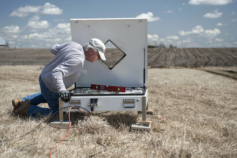
•Iowa Flood Studies (IFloodS ) is an April through June collaboration with NASA to collect Iowa precipitation data using rain gauges placed in the Cedar and Iowa River basins, along the South Fork of the Iowa River, and in the Turkey River basin. The purpose is to develop accurate satellite radar images as a part of NASA’s 2014 Global Precipitation Measurement project, which has the goal of developing better forecasts for Iowa and the entire nation.
•Presentation of a series of public forums in Cedar Rapids, Des Moines, Iowa City, and Muscatine as part of the Living with Floods project—a statewide series of events to mark the fifth anniversary of the historic Iowa floods of 2008, and to recognize and celebrate the strength and resiliency of Iowans in the face of repeated flood events. The project culminates with free, public performances by the Preservation Hall Jazz Band sponsored by Hancher.
“What’s really exciting,” says Carmen Langel, managing director of the IFC, “is that Iowans are starting to contact us to request stream-stage gauges for their communities, speakers for their programs, and access to IFC data. This means people are learning about the IFC and that we are fulfilling a critical need for our state.”
During the floods of 2008, Iowans suffered more than $1 billion in damage, including the loss of private homes, public buildings, and infrastructure such as roads and water systems. The IFC intends to mitigate similar damage in the future by providing more timely and complete river and stream information.
Professor Witold Krajewski, director of the IFC, says, “Initially, the IFC focused on providing critical information to Iowans related to flood risk and current flood-related conditions. This will always be an important part of our mission. In my vision for the future, we will continue to expand the IFC’s services, as well as research ways to decrease flooding by considering entire watersheds—not just localized levees and flood gates.”
The Iowa Flood Center is part of IIHR—Hydroscience & Engineering, a research institute based at the UI College of Engineering. The centerprovides accurate, state-of-the-science-based information to help Iowans better understand their flood risks. It is the nation's first academic center devoted solely to the study of floods.