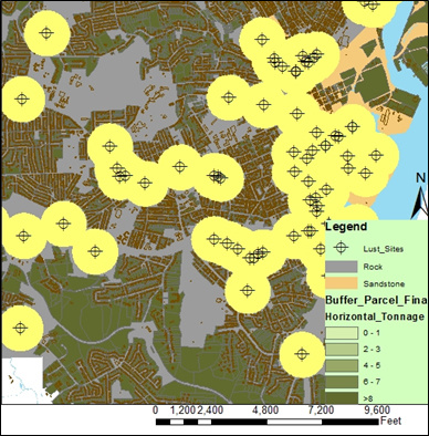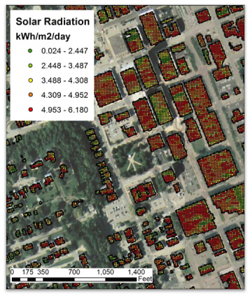
Using GIS (Geographic Information System) and 3D modeling, they're mapping a complete picture of Dubuque's energy needs and energy source potential. With these maps, students can show the city of Dubuque how to balance energy use and energy production as the city determines how best to invest in renewable energy sources.
They're developing an economic development tool for the Greater Dubuque Development Corporation that shows current and potential businesses how Dubuque will maximize dollars spent on renewable energy sources.
With their research results, the team is helping to address pressing policy issues that will enable the city of Dubuque—and other Iowa municipalities—to preserve historic character, boost disaster resiliency, and increase accessibility to renewable energy for a more sustainable, viable Iowa.

After the project's completion, the template and a description of mapping process will be available online. By publishing details about this novel approach to urban planning, the UI students hope their work in Dubuque will assist many Iowa municipalities.
These second-year master's students are enrolled in the Field Problems in Planning course, which has developed sustainability plans in eight Iowa towns since 2009. The course is part of the Iowa Initiative for Sustainable Communities (IISC).
The Dubuque Initiative is a two-year partnership between the UI and the city of Dubuque. This year, students worked with Dubuque area leaders on five projects. In addition to the renewable energy asset mapping project, groups focused on indicators and indicator measurements for the 11 sustainability principles, a portrait of poverty in Dubuque, local foods and local institutions, and the design of the Green and Healthy Homes program.
All five student teams will present their projects from 4:15 to 7 p.m., Tuesday, April 24, in Room 201 of the Continuing Education Facility, 30 S. Dubuque (second floor in the U.S. Bank Building). They will make final presentations in Dubuque to city leaders on Tuesday, May 8.